VIDEO: Your Weekend forecast + some life in the tropics
5/10/2022 11:46pm

> From the WeatherWatch archives
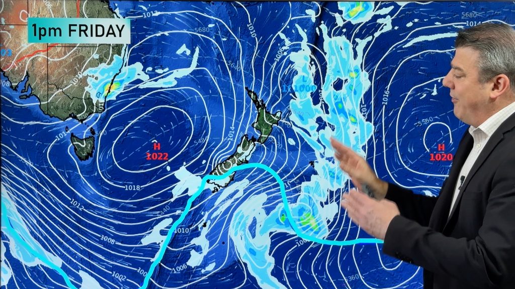
High pressure is moving into NZ, rain for Bathurst and the tropics are finally starting to wake up after winter/dry season.
We have staff away today, apologies the video looks a little different and has no tags/labels for each day – back to normal next week!
1) The wintry change in NZ this week is starting to wind down and by the end of Friday it will be mostly cleared from NZ, with high pressure and frosts rolling in – then the high departs by Sunday/Monday and that encourages a warmer northerly flow back of the country.
2) Aussie has more rainmakers in the south east, but it does finally ease later on Sunday. Windy and wet weather will hug NSW in particular – including Sydney, but does ease later this weekend. Bathurst looks wet to start with, drying out later in the day – and cool with a high of only 13C.
3) The tropics will see the easterly winds kicking in next week with a low forming near Tonga and the Cook Islands. Not a storm, but it is the first proper low to form under this new La Nina and the South Pacific Cyclone Season kicks off in just over 3 weeks (Nov1).
4) And we also say some kind words to MetService, following their very busy week too.
*Programming Note: Apologies but we have no video tomorrow/Friday, we’re back again on Monday though! Have a great weekend wherever you are.
Comments
Before you add a new comment, take note this story was published on 5 Oct 2022.


Add new comment
Andrew on 6/10/2022 7:09am
Agree with the Metservice warnings. Spot on and timed to the hour several days out. Thanks for your extensive coverage of the cold snap – fun as usual.
Now, La Nina….. As much as rain in eastern Oz is great, La Nina is damaging Nelson’s sunshine capital image…
Reply