Uncertainty about Cyclone Oma’s track next week means New Zealanders should monitor
13/02/2019 10:08pm

> From the WeatherWatch archives
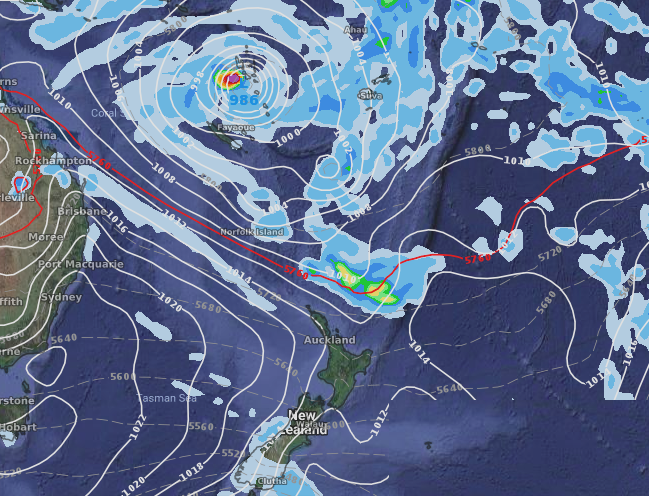
Slow moving Cyclone Oma has strengthened further and is now a Category 2 Tropical Cyclone just west of Vanuatu. The storm will inch slowly towards New Caledonia over the next couple of days and then stall there for much of next week.
For several days now the computer modelling has been unsure about what Oma might do once it moves on from New Caledonia later next week (possibly not for a full week from now). The two most likely options are A) It will track slowly west towards Queensland or B) Fall south into the Tasman Sea once high pressure over NZ clears away (which it may do for a time end of next week). If option “B” happens then a rainmaker may be coming to NZ. WeatherWatch.co.nz says confidence for this happening is around 30% at the moment.
As of today, Feb 14th, there is no direct threat to New Zealand from Cyclone Oma but WeatherWatch.co.nz is saying not only may Oma strengthen further and become a ‘severe’ Category 3+ storm in the Coral Sea in the week ahead, but that its positioning on the planet means a lot of natural forces want to pull it New Zealand’s way. It’s one to monitor in the days ahead – and if you need rain this may still be one of the best shots at getting it, but still a lot of moving parts to monitor and high pressure still has a greater chance of keeping much of the country dry for now.
CURRENT POSITION (GFS)
POSSIBLE POSITION NEXT FRIDAY FEB 22 (ECMWF)
 – Fiji Met Service – tracking
– WeatherWatch.co.nz
Comments
Before you add a new comment, take note this story was published on 13 Feb 2019.


Add new comment