Tuesday Newsfeed: Colder, wetter in the east – drier in the west
17/06/2024 5:00pm

> From the WeatherWatch archives
The large low might be in the Tasman Sea to our west but the bulk of the wet weather for Tuesday is along the eastern side of NZ and is thanks to HIGH pressure instead! The high will interact with the low to create a cold easterly flow into eastern NZ and due to the nearby low this will bring some rain and showers (and some South Island mountain snow in the east).
Elsewhere many regions are dry or mostly dry today.
Coldest air is in the eastern and inland parts of the South Island, mildest in the north and west of NZ.
Our latest video explains the complicated set up this week – and why low pressure may linger all this week, weekend and into next week too.

- Maps powered by Weatherzone, graphics by WeatherWatch
- WeatherWatch.co.nz
Comments
Before you add a new comment, take note this story was published on 17 Jun 2024.
Latest Video
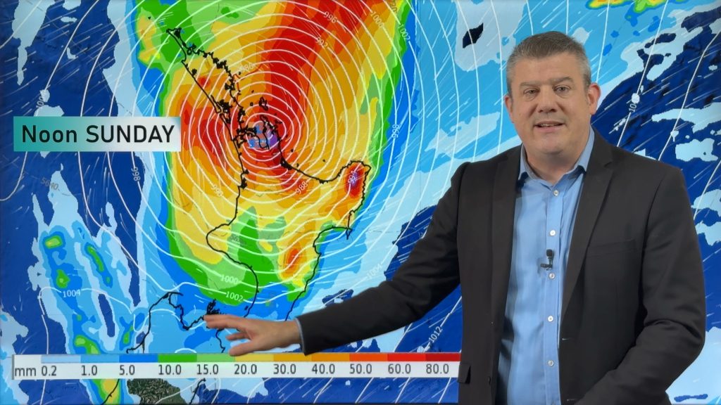
NZ (THU): Latest on Cyclone Vaianu, Sunday landfall in North Island
Severe weather is expected to develop as early as Saturday in the upper North Island ahead of Cyclone Vaianu, which…
Related Articles
NZ (THU): Latest on Cyclone Vaianu, Sunday landfall in North Island
Severe weather is expected to develop as early as Saturday in the upper North Island ahead of Cyclone Vaianu, which…
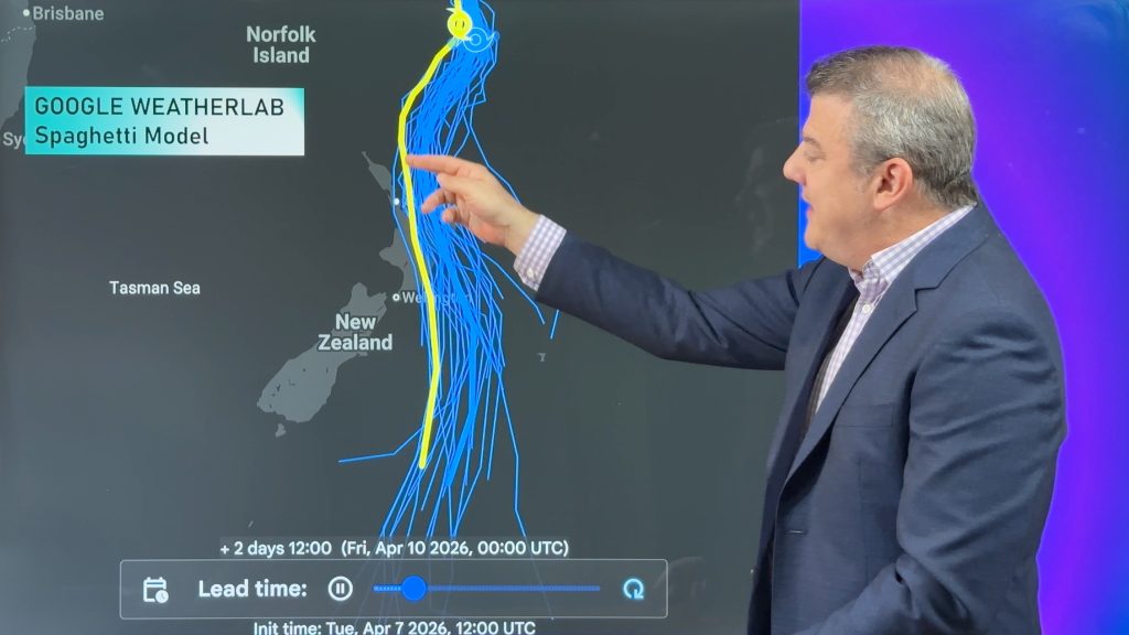
Tropical Cyclone Vaianu’s track directly into NZ this weekend
Localised heavy rain is still affecting some parts of NZ today, seperate to the tropical cyclone which is tracking directly…
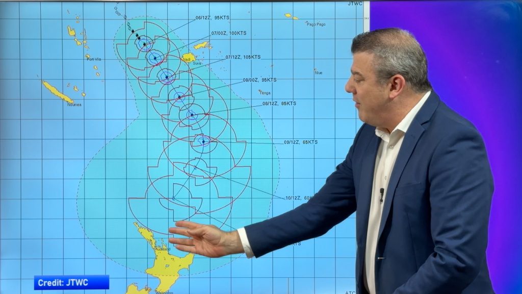
Tropical Cyclone VAIANU: Fiji then NZ
*Published Tuesday AM* Fiji is being affected today by offshore Severe Tropical Cyclone Vaianu and NZ has the chance of…


Add new comment