Tropical trouble: We track the tropical lows & how much rain is [not] coming over the next 14 days (+4 Maps)
4/02/2019 5:29am

> From the WeatherWatch archives
The tropics are about to switch up a gear with a number of big lows developing, including a possible tropical cyclone in our backyard but also a bubble of high pressure keeping some of this rain away from NZ itself.
Parts of New Zealand are now becoming very dry, in particular the upper North Island (Northland, Auckland and Waikato) also further south around Taranaki to Nelson and other parts of Central New Zealand.
Despite a big uptick in tropical lows and an increase in Southern Ocean rainmakers it appears New Zealand remains in a small bubble of high pressure which, unfortunately for those who might need rain, looks focused on these driest places.
It’s too early to know if the tropics will bring relief to the upper North Island this Sunday/Monday and the following week after, or if that rain will slide just off the east coast as it so often does.
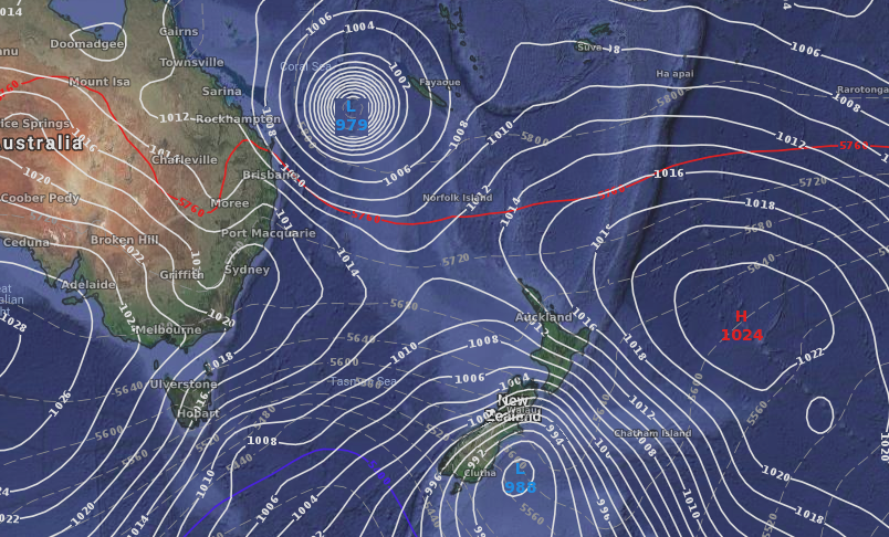
The first map below shows the first rain maker coming this Sunday/Monday (Map is for Monday 11th and shows the bulk of the rain and energy just to the east of East Cape). The second map below it is for the following Monday (18th) and shows a potential tropical cyclone in the Coral Sea north west of NZ well worth monitoring as in that position it may impact New Zealand.
 ABOVE – One week from now, Monday Feb 11th
BELOW – Two weeks from now, Monday Feb 18th
RAIN IS COMING BUT MOSTLY AT SEA:
A lot of rain is going to be falling at sea in the New Zealand and Australia areas with some large dry zones in central parts of both countries. We’ve circled in white the driest areas in the 14 day rainfall maps…these maps are produced by the US Government for New Zealand and show the expected total forecast accumulation from now up until February 18th.
We’ve gone big picture so you can see where the big rain makers are (in purple) and where the large dry zones are – to understand the big picture may help you understand locally why rain isn’t penetrating some of these dry zones despite large rainmakers being fairly nearby. It may be a frustrating couple of weeks for those who need rain but may miss out – so we’ll keep you posted on the potential for soaking rains.
14 DAY RAINFALL ACCUMULATION MAPS FOR NZ/AUSTRALIA:

– WeatherWatch.co.nz
Comments
Before you add a new comment, take note this story was published on 4 Feb 2019.


Add new comment