Thursday is windier and hotter in the NI, heavy rain for the lower West Coast
23/10/2024 8:27pm

> From the WeatherWatch archives
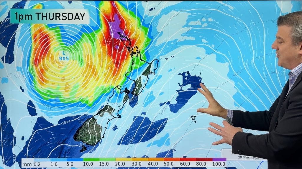
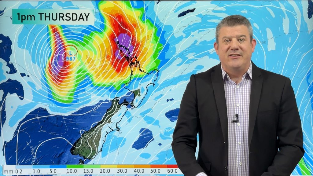
High pressure is parked north-east of East Cape today with windier and warmer west to north-west winds (with sub-tropical connections over the North Island) making it hotter in the east, as heavy rain sets in for the lower half of the West Coast.
Let’s get into the forecast for Thursday to begin with…
RAIN:
Heavy rain sets into the West Coast, mainly south Westland and Fiordland with heavy rain warnings in force by MetService. Dry elsewhere for much of New Zealand, but a few showers are possible in Southland and some rain may spillover into the west there, and also western Otago.
WIND:
West to north west winds are nationwide today with gales in exposed places and even the possibility of severe gale in the east and around some mountains. Lighter winds at the very top of NZ but still a breezy north to north-west flow kicking in for the upper North Island.
TEMPERATURES:
A warm to hot day today, especially in the east with those nor’westers and places like Hawke’s Bay – also receiving the sub-tropical airflow – has maximum temperatures between 25 and nearly 30 degrees.
FRIDAY & LABOUR WEEKEND
As we head into Friday conditions may ease back for a time – both wind and rain, although nor’westers might still be strong from East Cape to Wairarapa, but not too major. Light winds in the South Island, Still hot in the north and east of the North Island but a colder change arrives in Southland across Friday.
This Labour Weekend a large low pressure zone will develop and brings severe weather to the nation on Saturday, in particular over the South Island where heavy rain may affect multiple regions, even the north and east as airflows tilt more north to north-east, and that feeds in wet weather to Nelson, Marlborough and Canterbury too. A band of rain also moves down from Northland on Saturday – but if you live in the east and lower North Island many places may be dry or fairly dry. The low lingers on Sunday but weakens and by Monday it’s likely out to our east, leaving a showery west to south-west flow for the North Island and cooler air over the South Island.

As always drill down deeper with your hyper-local, hourly, FREE 10 day forecasts from WeatherWatch.co.nz – or download the FREE WeatherWatch App.
Comments
Before you add a new comment, take note this story was published on 23 Oct 2024.
Latest Video

Subtropical storm moving in, gales and some heavy rain, especially Thu/Fri
Heavy rain and gale winds will slowly move down the country over the next 24 to 36 hours a subtropical…
Related Articles
Subtropical storm moving in, gales and some heavy rain, especially Thu/Fri
Heavy rain and gale winds will slowly move down the country over the next 24 to 36 hours a subtropical…
Tropical storm to bring severe weather to NZ, gales & heavy rain
A tropical cyclone is today leaving the tropics and will grow into a larger storm system for a time in…
Tropical low to bring wind & rain this week
A low exiting the tropics near New Caledonia this week will grow larger in the Tasman Sea and finally bring…


Add new comment