Thunderstorms & downpours moving into NZ, mostly for North Island (+Animation)
28/05/2025 7:39pm

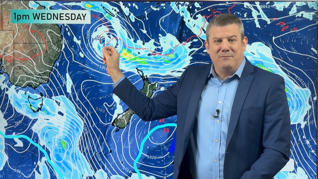
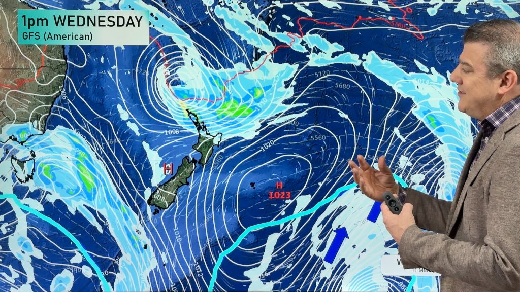
A significant burst of Autumn thunderstoms are moving into NZ today from the Tasman Sea and may cause some issues with cloud to ground lightning strikes, flight delays and the potential for localised flash flooding. Even if you don’t get an actual thunderstorm, you may still be affected by heavy downpous and instability caused by a large low pressure zone over the Tasman Sea, moving into the North Island today and tonight.
Keep up to date with MetService thunderstorm outlook here.
Here is the lightning loop showing the past 6 hours lightning leading up to 7:30am Thursday, thanks to our friends at Weatherzone.

Comments
Latest Video

Temperatures to lift, before dropping again this weekend
Subtropical and north-west winds will help boost temperatures around NZ both by day and night followed a colder couple of…
Related Articles
Temperatures to lift, before dropping again this weekend
Subtropical and north-west winds will help boost temperatures around NZ both by day and night followed a colder couple of…
Subtropical low vs subantarctic energy = typical early Autumn setup
A low pressure zone leaving Queensland tonight may brush the very top of the North Island midway through this week…
Subtropical low next week worth monitoring as high pressure controls all
High pressure smothers NZ today and will weaken a little on Sunday and Monday to allow a cooler southerly flow…


Add new comment
josh on 28/05/2025 9:41pm
are you sure thats not a police swarm coming to arrest the north island lol.
nah kidding . looking forward for some thunderstorms. maybe a isolated tornado too?
Reply
WW Forecast Team on 28/05/2025 11:38pm
Definitely the right conditions for a small tornado, or squall. Very hit and miss though!
– WW
Reply