This weekend’s headlines (x3): Rain arrives in the north later, Cool start inner South Island, Weather on Sunday
10/02/2023 6:00pm

> From the WeatherWatch archives
Here’s what is making the weather headlines this weekend.
RAIN ARRIVES IN THE NORTH LATER
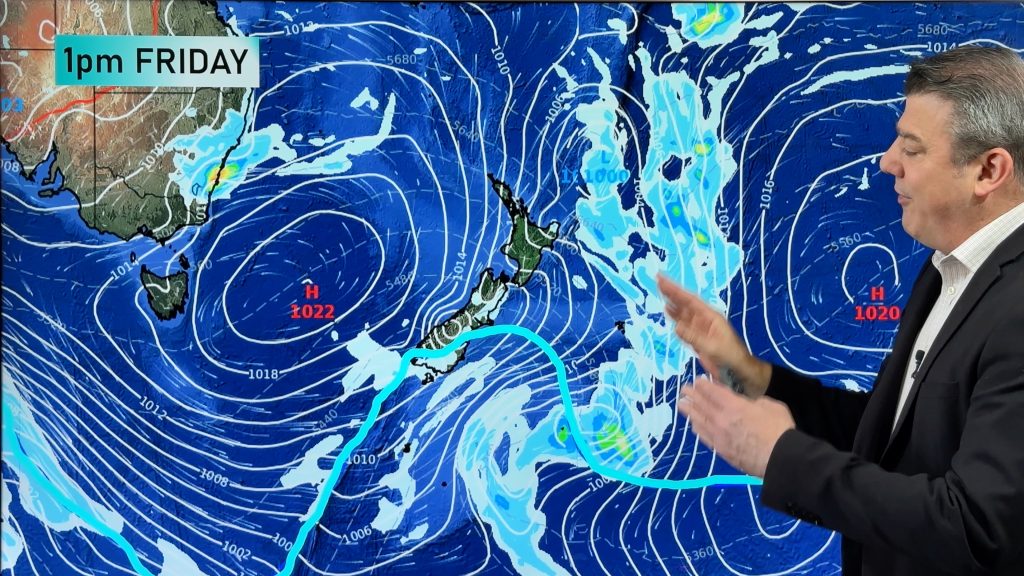
While northeastern parts of the North Island have showers today it’s not till later this evening or overnight that rain arrives in Northland.
The far south of the South Island and the West Coast can expect some very nice weather and warm temperatures this afternoon.

COOL THIS MORNING – INNER SOUTH ISLAND
While not overly cold temperatures this morning about inland parts of the South Island may start out in single figures.

WEATHER ON SUNDAY – Tropical Cyclone Gabrielle moves closer
North Island
An east to southeasterly airflow strengthens as tropical cyclone Gabrielle approaches tp the northwest, gale to severe gale southeasterlies for the upper North Island especially about coastal parts. Cloudy skies all day with rain in the east and for the upper North Island, Coromandel, north of Auckland then later in the day East Cape sees some heavy rain.
South Island
Mostly sunny, a few afternoon clouds about inland hills and ranges may produce an isolated shower otherwise mainly dry. Nelson and Marlborough see a mix of sun and cloud during the day with Marlborough perhaps seeing light showers or drizzle patches. Winds are light tending onshore in the afternoon, east to northeast winds freshen up in the east after midday.

Comments
Before you add a new comment, take note this story was published on 10 Feb 2023.


Add new comment