The tropics are unsettled – what this means for NZ in March (+5 Maps)
19/02/2023 10:21pm

> From the WeatherWatch archives
(No weather video today – back Tuesday) — As we approach the peak of the cyclone season it’s clear there are a number of low pressure zones north of New Zealand in the coming weeks. Following Cyclone Gabrielle there is heightened concern that we’ll get more storms here – so what is the likely forecast and what should we be looking for?
Late February and March – especially in a La Nina season (albeit a weak La Nina) – is the peak time for tropical lows and storms to form north of New Zealand. The risk is there almost every summer but often New Zealand is protected by large high pressure zones, which keep these storms well north of us.
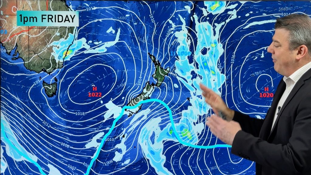
For the first time in over half a decade these high pressure zones in New Zealand have dropped much further south over the South Island, leaving the North Island more exposed to easterlies and low pressure from the sub-tropics or tropics. We’ve seen this pattern dominating since spring 2022 and across summer so far – with no sudden change in sight coming for March.
The high pressure zones in the NZ area are key to guiding storms. Had there not been a high pressure system east of NZ for Gabrielle, the storm would’ve had freedom to pass NZ faster, possibly not as deep and stormy either. The high played a key role in the precise tracking of Gabrielle – and making it worse for us.
Whilst the high pressure zone with Gabrielle made it worse for NZ – most actually protect us. It’s why major cyclones are rare – perhaps one a decade here on average.
For a tropical cyclone to hit us directly it needs a clear path to NZ, it needs steering high pressure and it all needs to time itself perfectly.
So the sight of plenty of low pressure zones north of New Zealand should be taken with a bit of caution – because you still need that guiding high pressure to be parked either well south of NZ or well east of NZ for it to have much impact. The timing has to be perfect. If not, the storms will fall apart at sea – or be pushed in over Queensland or elsewhere.
For now, the chance for further lows developing in the tropics over the coming weeks is fairly high – but the chance of any lows becoming cyclones for NZ are currently rated as low, or “very low”. Even if you see a storm in the same place that Gabrielle deepened (the Coral Sea) it doesn’t mean it will drift the same way due to all the many moving parts of air pressure that make tracking unique for each storm.
Australia’s BoM says the chance of a tropical cyclone forming in the next 3 days is “very low” despite lows being in the area.
High pressure made Gabrielle worse for NZ – but the next high may be the system that stops the next one from hitting us. It’s why every single storm is unique – and every single track towards NZ is unique. Gabrielle was a rare storm that ticked all the right boxes two weeks in advance, something we almost never see. At the moment, there is nothing as clear as that in our forecasts – but we are monitoring tropical storm risks around the Coral Sea and east to Fiji over the coming two weeks as we enter the peak of the storm season for the Southern Hemisphere.
For now though, high pressure in the NZ area looks to push back, keeping tropical lows mostly north of NZ. But as you can see from the maps below, the tropics have plenty of energy and will require closer monitoring daily (by forecasters) for the coming several weeks ahead as it’s a bit of a messy set up at times. But mostly, high pressure is protecting NZ rather than harming NZ in the maps below.
- Story by head forecaster Philip Duncan.
- Programming Note: We have NO VIDEO today, we resume normal daily videos from tomorrow, Tuesday.
- WeatherWatch.co.nz


Comments
Before you add a new comment, take note this story was published on 19 Feb 2023.


Add new comment
Eva on 20/02/2023 6:16pm
Today is Tuesday😏
Reply
Peter Shone on 20/02/2023 10:24am
No good, you should be on deck Monday to Friday.
Day off on Monday is lax.
Don’t you have the personnel required staff numbers to maintain a reliable service?
Reply
WW Forecast Team on 20/02/2023 7:12pm
Hi Peter – feel free to pay for any of the services you use from us. We’ll happily take $1000 from you today to hire back up.
You currently tax fund/PAY FOR Niwa and tax fund/PAY FOR MetService – but pay our small business nothing at all but demand we do better.
Have a happy day
– WW
Reply
Grant on 21/02/2023 12:03am
Nice retort WW team! I highly rate your service
Reply
Bryan Norton on 20/02/2023 10:00am
Thanks Weatherwatch. I always appreciate your overviews and long-range modelling which helps with planning projects.
Reply
williem maclutchie on 20/02/2023 6:55pm
the earth is groaning from the weight of sin ok
Reply
Michael on 20/02/2023 8:49am
This question may be a bit off topic. Looking at the maps its looking like Fiji should avoid cyclonic weather over the late Feb-early March period (I have some holidays booked in during this time). Is this a correct assumption, or are the tropics too chaotic at this time of year to tell this far out?
Reply
View more comments