Temperature trends – Canty, Central Otago chilliest tonight; Sat’s temps average or above everywhere
29/05/2020 3:00am

> From the WeatherWatch archives
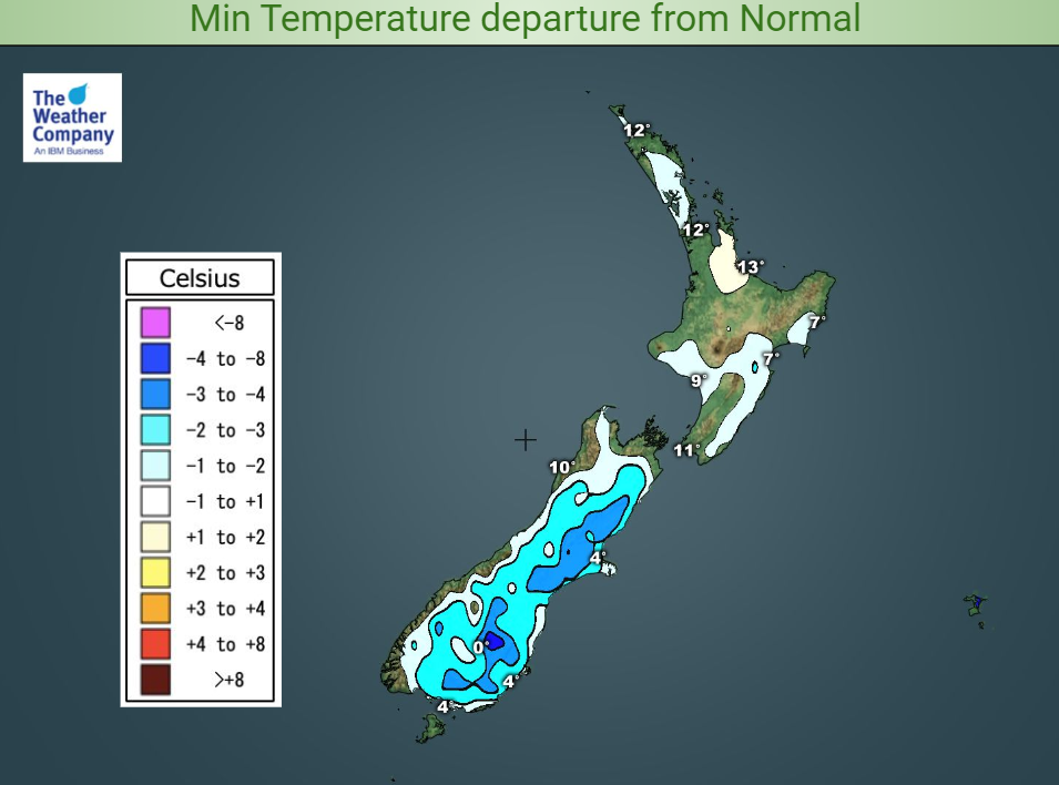
Even a quick glance at the minimum temperature map for tonight shows where most of the cloud is over Aotearoa.

There’s little to report for most of the North Island when it comes to overnight temperatures – the meteorological excitement there mainly comes in the form of rain and thick cloud sheets.
Auckland’s low of around 12degC and Wellington’s of about 10degC are pretty much average for the last few days of May. The cooler North Island spots are down the east coast, where minimums may fall to about 6-7degC.
South Islanders, however, are in for a colder night than average, once the cloud that has lingered today starts to clear.
Inland Canterbury and Central Otago are looking particularly chilly, with lows in the morning there possibly up to 5degC colder than normal, signalling some moderate frosts in sheltered spots.
Parts of Marlborough, Nelson and down the West Coast to Fiordland will have a more average night, where cloud lingers.

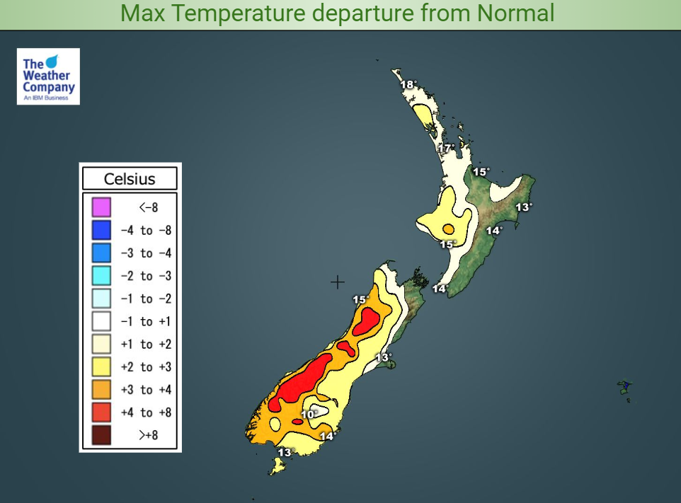
Saturday promises to be a bit milder than normal in western parts of both islands. That trend is especially evident in the inland South Island, and towards the western side of the Southern Alps, where light winds and clear skies could push temperatures several degrees above average.
Afternoon temperatures east of the main ranges on both islands will be about normal. The warmest North Island location on Saturday afternoon looks to be inland of Whanganui.
For Max & Min NZ Temperature maps for the next few days and nights ahead, please visit our new maps page: https://www.weatherwatch.co.nz/maps-radars/temperature/temperature
By Guest Weather Analyst Paul Gorman – WeatherWatch.co.nz
Comments
Before you add a new comment, take note this story was published on 29 May 2020.


Add new comment