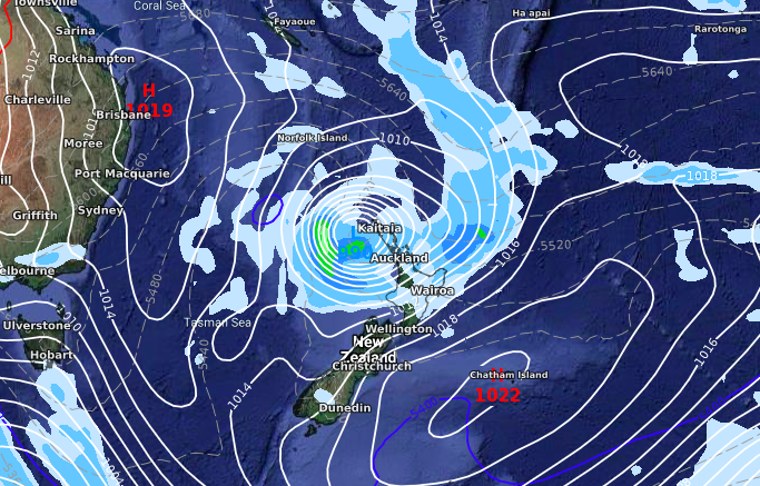
Sub-tropical low next week may bring severe weather (+2 Maps)
9/10/2019 9:36pm

> From the WeatherWatch archives
Another low that will quickly deepen overnight Sunday and into Monday may bring severe weather to the upper North Island early next week but it’s still too early to lock in.
Reliable modelling has been fairly sure of the sub-tropical low developing for over a week but there remains uncertainty if it will grow and reach severe weather criteria. If so, there is a chance for heavy rain warnings and strong wind warnings for the upper half of the North Island on Monday and Tuesday.
Marine conditions will also likely become dangerous around the top half of the island on Monday and Tuesday.
We should have more news and certainty over the next day or two about severe weather potential (if any). Keep an eye on our rain maps and 10 day local forecasts for more details until our next news update on this low.
Maps are for Monday PM
GFS (American modelling)
ECMWF (European modelling)
– WeatherWatch.co.nz
Comments
Before you add a new comment, take note this story was published on 9 Oct 2019.


Add new comment