Stormy weather going into Easter – latest on large low expected this week (+Maps/Animations)
12/04/2025 9:32pm

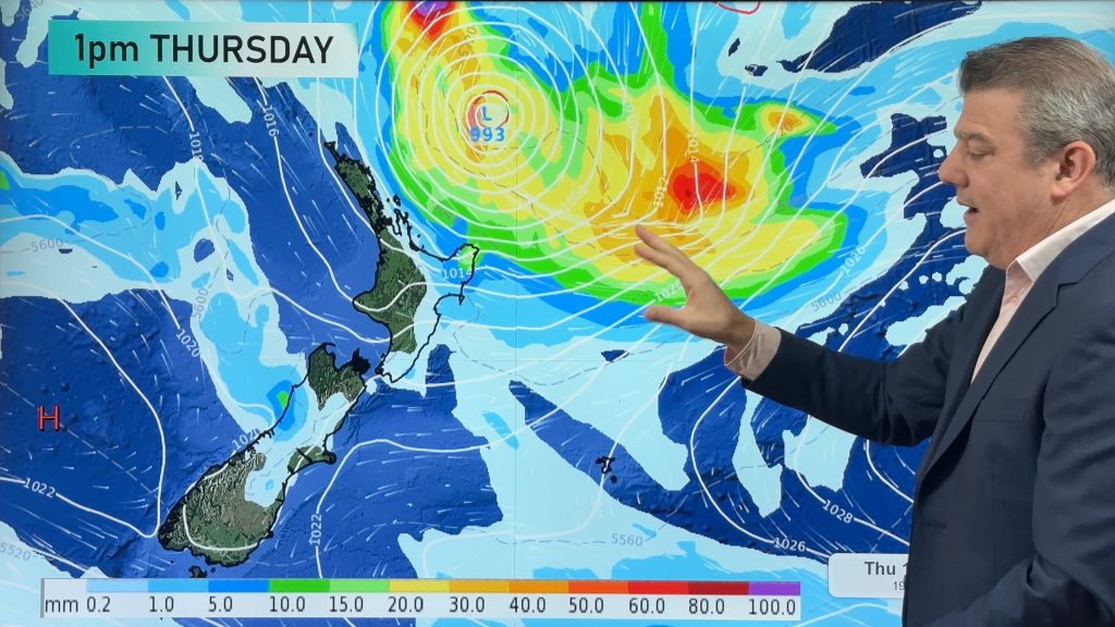
Severe weather is expected in parts of New Zealand mid to late week and going into the long Easter weekend as a low from the tropics drops southwards and rapidly deepens. Tropical low pressure has been trying off and on for months to drop southwards, but a frequent bubble of high pressure around NZ has kept us so dry it not only stopped much of this rain, it also lead to drought here.
Now we have a “gap between the highs” which allows this low to drop southwards and it will deepen (power up) as it does so. This is not a tropical storm – as it will actually be quite weak in the tropics. But the low will drag down tropical rain and grow once it nears New Zealand over Tuesday and Wednesday and it will then interact with a strong high pressure system over the South Island and Chatham Islands.
This creates a squash zone (additional windy easterly weather between the exiting high and incoming/deepening low – and this can slow down rainfall too). The low itself brings stronger winds as the air pressure drops.
Put short, the set up this week is changeable – but we do expect a period of heavy sub-tropical rain which may be a drought breaker. Winds may also be damaging mid to late week over a number of regions.
Severe weather may impact both main islands from Wednesday to Saturday, but the North Island currently looks most exposed. Power outages, slips and flooding are possible – but it’s too early to lock in, with forecasts moving around still.
The low is expected to fall apart over Saturday and Sunday bringing fewer chances of severe weather and larger drier/calmer areas for Monday as high pressure returns from the west, likely with a cooler southerly for some.
Not all parts of NZ have severe weather. Your local WeatherWatch or RuralWeather.co.nz forecast will help you make sense of it all wherever you are this coming week and long weekend.
This remains a changeable forecast because the low is not like a tropical cyclone (where all the energy/severe weather is near the centre of the storm). Severe weather may be well away from the centre of the low, shifting around a bit each day and broken up due to our mountains and ranges. The centre of the low and the weather near it may be quite calm, even sunny, but also more likely to produce isolated thunderstorms and instability (changeable forecasts) – perhaps around Saturday as it finally falls apart over the country.
Precise placement of where this still-to-develop low pressure zone will be by mid to late this week matters when trying to be precise about severe weather… so it may not be until Tuesday or even Wednesday that more of those details will become clearer.
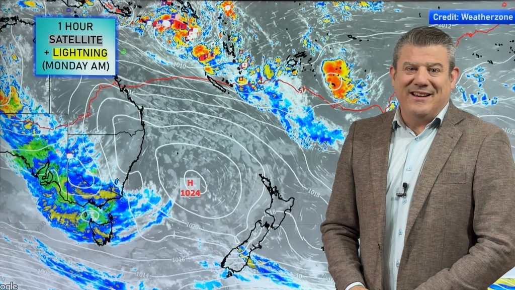
We’ll break it down in more detail in Monday’s weather video update, usually out around the middle of the day.
Useful Links & Maps:
Wind Maps
Rain Maps


- WeatherWatch.co.nz / RuralWeather.co.nz / Free APP
Comments
Latest Video
Subtropical low (yes, another one) to brush the NI, high pressure still in charge
A subtropical low will power up over the next 24 hours and brush past the north-eastern corner of the North…
Related Articles
Subtropical low (yes, another one) to brush the NI, high pressure still in charge
A subtropical low will power up over the next 24 hours and brush past the north-eastern corner of the North…
NZ weather: Skies will get drier before they get any wetter
High pressure is the main feature of New Zealand’s weather this week, the upcoming weekend and likely kicking off next…

NZ 8 Day: High pressure to return, also monitoring tropics next week
A cooler change is moving into NZ tonight and Saturday then winds ease further on Sunday as high pressure starts…


Add new comment