NZ VIDEO: Severe weather risks over the days ahead
26/08/2025 11:30pm
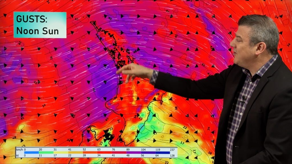
Damaging gales, rain/showers, some snow and a couple bursts of polar air are all on the way for New Zealand over the coming days, weekend and early next week.
Windy weather – mostly westerly driven – will ramp up over the next few days with Sunday looking especially windy around the North Island and then on Monday more central parts of the country.
Snow may get down to 300 or 400m for a time in the lower half of the South Island and 800m for the North Island but most heavy snow will be in the Southern Alps at higher elevations and North Island mountains.
Rain, heavy at times, moves into the West Coast with rain and showers for the western NI. Driest areas are the east of both main islands and the very top of the North Island.
We have a detailed forecast through until Tuesday of next week.
Comments
Latest Video
Yes, NZ’s weather is warming back up again
Temperatures lift on Wednesday for many, then further going into Thursday and Friday as subtropical and/or nor’westers return. Cooler southerlies…
Related Articles
Yes, NZ’s weather is warming back up again
Temperatures lift on Wednesday for many, then further going into Thursday and Friday as subtropical and/or nor’westers return. Cooler southerlies…
ClimateWatch: MARCH is looking quite orderly to start with
Storms near Antarctica, Autumn’s westerlies building south of Australia & NZ, high pressure again affecting both nations and the tropics…
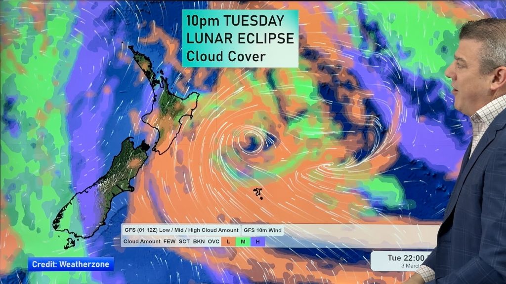
Colder tonight for many, Lunar eclipse Tuesday, high pressure dominates
A lot of low pressure is spinning east of the country while a large high is moving in – this…


Add new comment
JustMe on 27/08/2025 8:01am
Dear farmers,
You heard the man (Phillip D.).
A gnarly wintery blast is coming through.
Get those lambs & calves IN A BARN !!!! We do that in Canada.
Barns in winter save stock.
All the best.
Reply