NZ VIDEO: Colder & drier air for a week, but some get showers for days
8/08/2025 12:59am
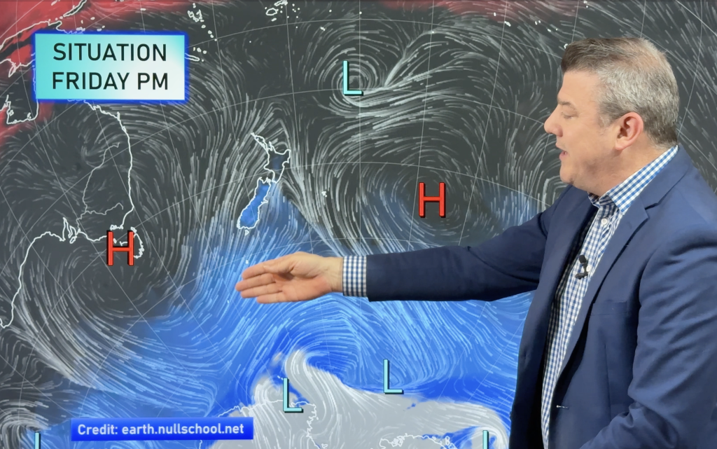
High pressure is returning to NZ this weekend but some will have lingering showers through into next week as a wintry southerly flow sets in.
Friday and Saturday are the wettest (with snow higher up) and frosts then expand going into the weekend and into next week.
Polar air will linger over basically the entire country for the next week ahead – perhaps bringing the coldest week of the year so far from a nationwide point of view.
Programming Note:
Next week we are changing our editing studio and may create some delays publishing our videos – just a heads up in case they are published an hour or two later next week as we get settled.
Comments
Latest Video

Temperatures to lift, before dropping again this weekend
Subtropical and north-west winds will help boost temperatures around NZ both by day and night followed a colder couple of…
Related Articles
Temperatures to lift, before dropping again this weekend
Subtropical and north-west winds will help boost temperatures around NZ both by day and night followed a colder couple of…
Subtropical low vs subantarctic energy = typical early Autumn setup
A low pressure zone leaving Queensland tonight may brush the very top of the North Island midway through this week…
Subtropical low next week worth monitoring as high pressure controls all
High pressure smothers NZ today and will weaken a little on Sunday and Monday to allow a cooler southerly flow…


Add new comment
Andrew on 8/08/2025 2:54am
You’re between a rock and a hard place with that cold spell 10 days hence.
Like you say, it has to be mentioned as it’s in the media.
Cold and unsettled is about as accurate as that can be!
Still, it’s good to see we may finally get a cold outbreak this winter. Apart from occasional frost it’s not been particularly chilly.
Reply
Claire on 8/08/2025 1:52am
Hi 🙂 We are based in Ohakune (in Rangataua actually just outside Ohakune) and very rarely get any kind of indication as to what our weather is doing. Where we are placed at the base of Mt Ruapehu can mean we are often in our own micro-climate and can frequently get very different weather than the areas on the news which typically tends to be Waiouru, Whanganui or Taupo. Would love if you could incorporate some weather for our area as we rely heavily on the weather for our tourism and knowing whether we are likely to get bookings/cancellations for the hundreds of Aucklanders and Wellingtonians that head our way for the ski slopes. There always seems to be a huge gap across the central plateau area whenever weather is reported across major stations and yet there are many of us that live here!! Thanks in advance 🙂
Reply
WW Forecast Team on 11/08/2025 2:04am
Hi Claire, when it’s snowing in the area I try to be more detailed where I can (sometimes can be hard) – but I do understand completely what you’re saying!! 🙂
Cheers
-Phil D
Reply