NZ VIDEO: Big frosts as high pressure flirts with NZ
16/07/2025 12:22am

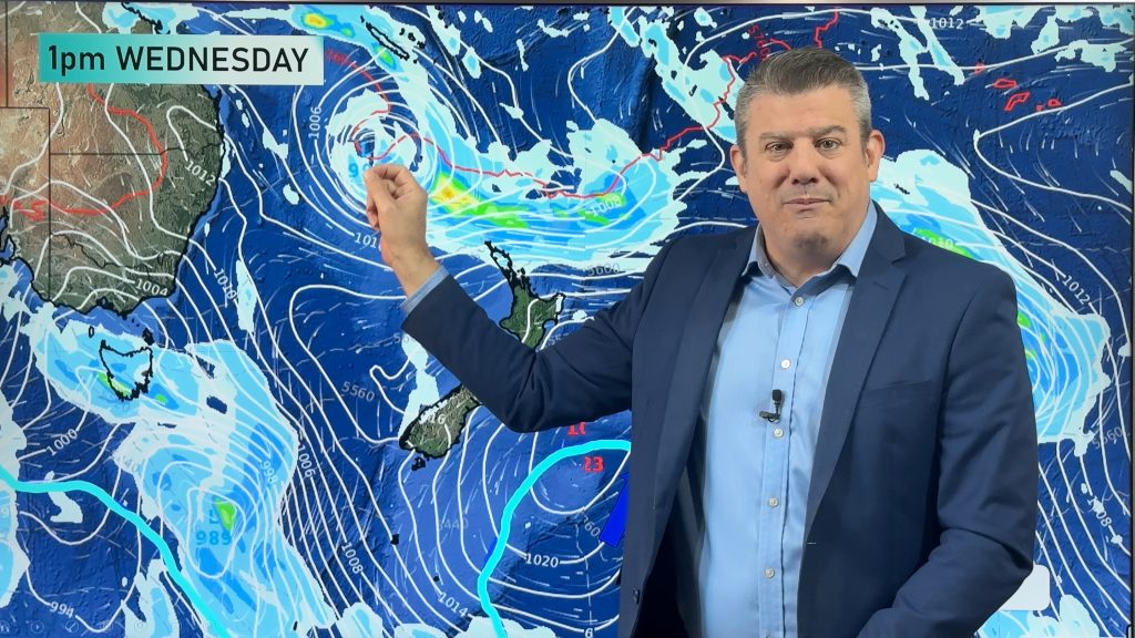
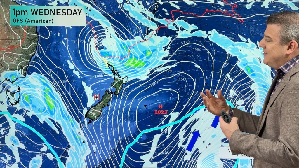
A low will cross the North Island on Thursday while heavy frosts (-5C and below!) will affect inland parts of the South Island as weak high pressure crosses there.
As we head into the weekend colder air moves further up NZ – but high pressure remains just offshore to our west, meaning some areas will have a colder southerly blowing – and maybe a few showers.
There are lows forming all around us – one in the Tasman Sea crosses northern NZ overnight tonight and hangs around on Thursday before clearing east. Other lows surround NZ this weekend.
To our Pacific Island viewers, we also have a tropical low forming near Fiji next week with heavy rain and some wind potential – we comment on this out of season tropical low.
We also have a new website for those of you into boating, surfing – or anything to do with the beach with a new data site giving free access to more useful tools.
Comments
Latest Video

Temperatures to lift, before dropping again this weekend
Subtropical and north-west winds will help boost temperatures around NZ both by day and night followed a colder couple of…
Related Articles
Temperatures to lift, before dropping again this weekend
Subtropical and north-west winds will help boost temperatures around NZ both by day and night followed a colder couple of…
Subtropical low vs subantarctic energy = typical early Autumn setup
A low pressure zone leaving Queensland tonight may brush the very top of the North Island midway through this week…
Subtropical low next week worth monitoring as high pressure controls all
High pressure smothers NZ today and will weaken a little on Sunday and Monday to allow a cooler southerly flow…


Add new comment
Hayley on 16/07/2025 7:05pm
Big thanks for Weatherwatch.co.nz
I am a market gardener whose livlyhood depends premempting weather changes and events to lessen possible damages. I’ve learned so much about reading the maps and tracking weather systems from your videos and truely appreciate the shared info.
Reply
WW Forecast Team on 19/07/2025 1:16am
Hi Hayley,
Thanks heaps for the great feedback, love that we can help you out in some way. Makes our job very worthwhile to read comments like yours.
Thanks!
– WW
Reply