NZ VIDEO (7 Day): High pressure, frosts, expand as big lows surround us
18/07/2025 12:09am

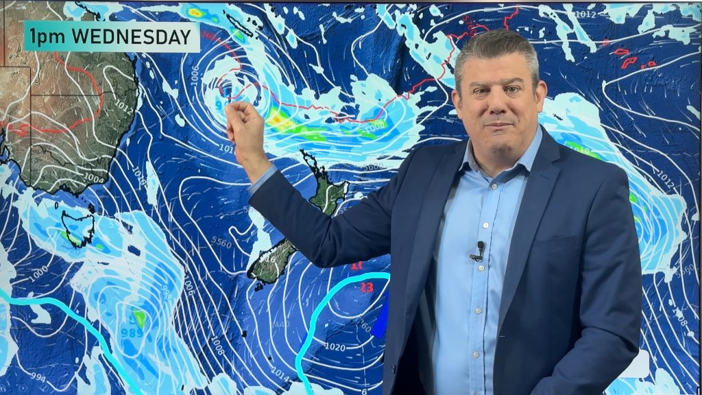
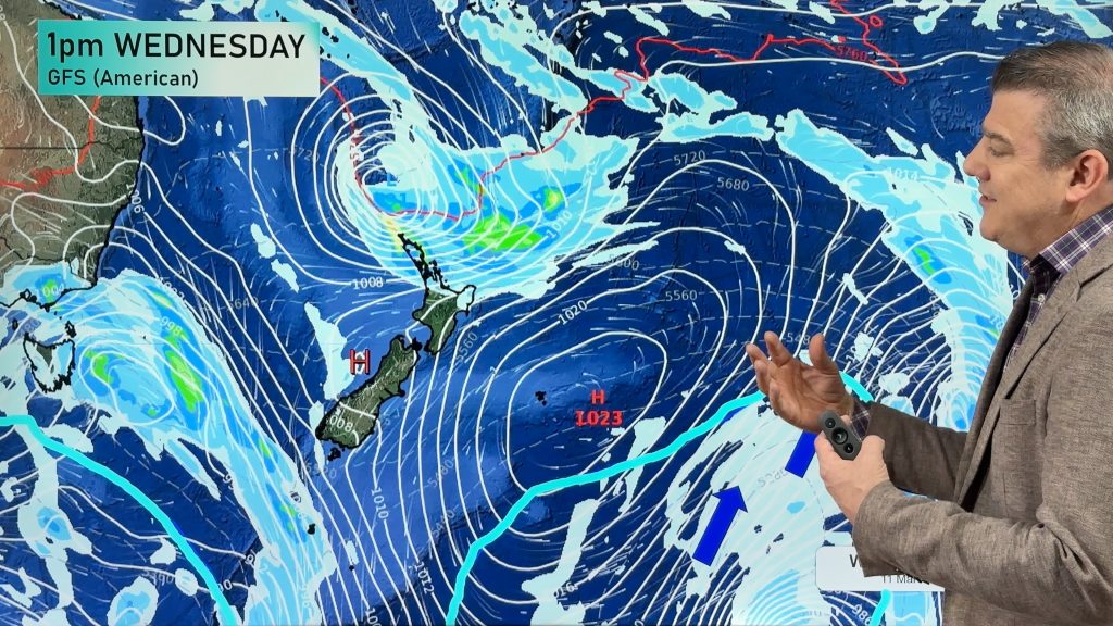
Most of you will be pleased to know drier weather is coming for most parts of New Zealand. High pressure will remain east of the country this weekend, encouraging a south to south-east flow into some regions and a few showers – but large dry areas develop and frosts become the most widespread we’ve seen so far this year into the North Island.
A sub-tropical low next week may put the squeeze on those south-east winds over northern NZ, especially as high pressure strengthens and crosses the South Island.
7 days of colder, drier, weather is on the way – with a reduction in severe weather risks nationwide. In saying that, we’re monitoring two stormy areas – one directly north of NZ and the other directly south of Australia as we go through next week.
We also have NZ’s 7 day expected rainfall map
Comments
Latest Video

Temperatures to lift, before dropping again this weekend
Subtropical and north-west winds will help boost temperatures around NZ both by day and night followed a colder couple of…
Related Articles
Temperatures to lift, before dropping again this weekend
Subtropical and north-west winds will help boost temperatures around NZ both by day and night followed a colder couple of…
Subtropical low vs subantarctic energy = typical early Autumn setup
A low pressure zone leaving Queensland tonight may brush the very top of the North Island midway through this week…
Subtropical low next week worth monitoring as high pressure controls all
High pressure smothers NZ today and will weaken a little on Sunday and Monday to allow a cooler southerly flow…


Add new comment
Wayne on 18/07/2025 12:21am
Thanks again for the great weather report for the coming week.
Reply
WW Forecast Team on 19/07/2025 1:15am
Thank you Wayne 🙂
– WW
Reply