New Zealand next few days: Heavy rain possible…but not locked in (+4 Maps)
15/09/2018 7:03pm

> From the WeatherWatch archives
Most parts of New Zealand will enjoy spring warmth today but from Sunday afternoon a well-marked cold front will sweep the lower South Island. Northwesterly winds ahead of the front will be enhanced. The western side of the South Island will be wet, with a few hours of intense ran fall (around 10-30mm/h) coming in tonight associated with the front.
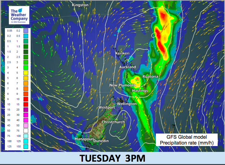
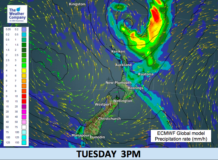
On Monday morning this rain will move in to the upper South Island and include Canterbury and Marlborough, as a low pressure system starts to form off the east coast of the island. The front will sweep the North Island to produce showery rain from Monday but not until late night and in to Tuesday. Additionally, a low pressure system will be formed to the north of the North Island and this will have a potential to bring heavy rainfall in to the upper North Island.
The confidence of the heavy rain risk in the North Island on Tuesday is low, as there is still large uncertainty about the forecast track of the low.
The worst case scenario is a low moving southwards across Bay of Plenty on Tuesday afternoon. If this occurs, rain accumulation over 100mm around coastal areas in Bay of Plenty is possible. Short-duration rainfall over 10mm/h over wide areas in the upper North Island, including Auckland, is also possible. It is important to keep an eye on the latest forecasts to assess the risk of this event, as the forecasts will converge from current multiple scenarios into a certain scenario in over the next day or so.


– WeatherWatch.co.nz
Comments
Before you add a new comment, take note this story was published on 15 Sep 2018.


Add new comment