Monday Newsfeed: Windy & cooler start to week, then high pressure & milder late week
11/08/2024 7:07pm

> From the WeatherWatch archives
The Big Picture weather-wise is that Monday kicks off with a windy south to south-westerly flow and a cold front moving up the country. Those winds and showers and southerlies ease back on Tuesday and even further on Wednesday as a big, strong, anticyclone moves in from the Tasman Sea. This high pressure zone will cross the top of New Zealand on Thursday, ushering in a windy, milder, westerly over the South Island. On Friday mild subtropical winds from near Fiji and Tonga look to move down over parts of NZ as the high moves off the country to our east. Low pressure is possible this weekend bringing northern rain – but is not yet locked in. We’ll have more details in our weather video out around lunchtime Monday.
RAIN – MONDAY:
A weak cold front races up NZ with wettest weather mostly along the southern and eastern sides of both main islands. The front will clear East Cape around midnight. Rain and shower accumulation is low today for most places.
WIND – MON to WED:
Strong south to south-west winds move across the nation on Monday with gales possible in exposed places as the front moves through. These winds ease further overnight Monday and across Tuesday – and further still on Wednesday.
TEMPERATURES THIS WEEK:
Despite cooler air moving in on Monday and Tuesday, temperatures over the next few days will quickly start to climb above average for this of the year, thanks to airflows coming from out of Australia.
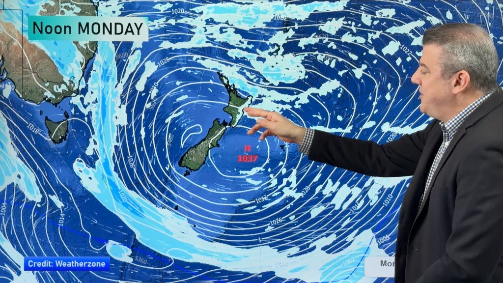
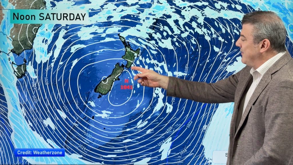
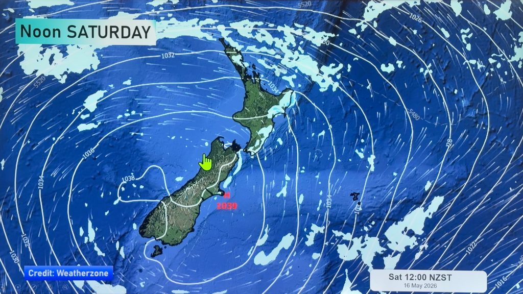
LATER THIS WEEK & WEEKEND
High pressure is out over the Tasman this week and will dominate NZ’s weather over the working week. The centre of this high will likely cross the upper North Island on Thursday and this brings in a windier westerly for the South Island and pushes temperatures up further beyond normal for this time of year. In fact by Friday subtropical winds from around Tonga and Fiji will be dragged down over central and northern parts of the country.
This coming weekend isn’t yet locked in, but this departing high will drag down more mild airflows for the North Island, while a low pressure zone is likely to move in from the Tasman Sea bringing some rain into the North Island. We’ll have more details on this across the coming week.
OUR DAILY WEATHER VIDEOS:
Programming Notes:
– We have two videos out today/Monday: NZ and Australia updates through to this Sunday
– We have NO VIDEO on Tuesday this week (in part due to the very quiet weather).


- As always drill down deeper with your hyper-local, hourly, 10 day forecast at WeatherWatch.co.nz or download our app.
Comments
Before you add a new comment, take note this story was published on 11 Aug 2024.
Latest Video
NZ 8 day outlook as high pressure moves through
High pressure will cross the South Island this weekend bringing light winds, cold nights, frosts and fog, while the North…
Related Articles
NZ 8 day outlook as high pressure moves through
High pressure will cross the South Island this weekend bringing light winds, cold nights, frosts and fog, while the North…
Eastern cloud/showers for the NI, high pressure expands elsewhere
A colder south to south-east flow will keep clouds and showers moving into some eastern parts of the North Island…
High pressure growing slowly, eastern showers for NI
A colder airflow is spreading across all of NZ now and will continue on as high pressure slowly moves towards…


Add new comment