Low pressure to swamp NZ this week; some rain, lightning, wind & temperature drop (+12 Maps)
15/12/2024 9:00pm

> From the WeatherWatch archives
This week is all about low pressure and colder air mixing in. NZ’s mountains and ranges will break up the wet weather bringing dry and windy areas too.
A temperature drop is also coming for the country after weeks of above normal temperatures, this may produce some thunderstorms.
Let’s get into the forecast for Monday to start with…
RAIN:
Rain and showers brush the top of the North Island thanks to that offshore low, while some wet weather moves up the South Island with a colder southerly or south-easterly change. A light dusting of snow is possible on the tops of the mountains in the very lower South Island.
WIND:
South to south-east winds will ramp up in parts of the South Island as that colder change moves in. Winds aren’t too strong for the North Island.
TEMPERATURES:
Colder air moves up the South Island on Monday with some in the southern half having a colder than average day for mid-December. The North Island sees no changes but that southerly will move into Wellington on Monday evening and may bring some thunderstorms with southerly gales – and will mean the lower half of the North Island will be colder on Tuesday.
WEEK & WEEKEND AHEAD
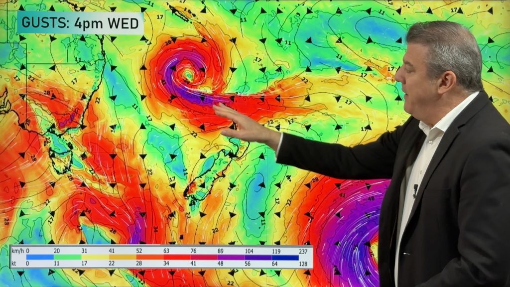
On Tuesday that northern low may become an offshore storm and east to south-east gales will develop over the eastern North Island from about Gisborne to Wellington and maybe into Central Plateau and surrounds too. Dangerous beach conditions are likely/possible in exposed parts of the eastern North Island on Tuesday (and Wednesday). There will be some wet weather for those dry eastern areas too – but also on Tuesday dry weather will continue across much of the rest of NZ with nor-easters blowing down the eastern side of the South Island in particular. Inland areas may be colder and calmer with below zero temperatures in the mountains and ranges at night. Frosts may also be possible in Northern Southland!
For the North Island Wednesday is a repeat of Tuesday with windy conditions due to the offshore storm to the north-east of the country and some wet eastern weather. The South Island looks dry with lighter winds but windier nor’westers develop around Southland and Otago. Again on Wednesday morning temperatures below zero are likely in alpine and high elevation areas of the upper South Island.
The weather gets messier on Thursday and Friday as a new area of low pressure forms right over NZ – taking energy away from that northern low. Despite this larger low forming late week – and over the weekend – it doesn’t appear too severe (but well worth monitoring, especially if you’re camping or outdoors and certainly for mariners).
To sum up: This week will see rain and showers right across the country, windy weather in both main islands for a time, with a drop in temperatures coming for most.
Dress warmly if camping or tramping in the South Island in particular with sub–zero weather at high elevations possible, and near zero temperatures are possible around Central Plateau in the North Island on Tuesday night/Wednesday morning too.


Drill down deeper with your hyper-local, hourly, 10 day forecasts by downloading the FREE WeatherWatch Alerting App.
Comments
Before you add a new comment, take note this story was published on 15 Dec 2024.


Add new comment