Just a few issues, otherwise mainly settled – NZ’s Weather Highlights for next 3 days
29/08/2016 7:00pm

> From the WeatherWatch archives
Today is mainly settled in a west to southwesterly airflow, and settled again on Wednesday due to a ridge of high pressure. Then, on Thursday, a northwesterly airflow develops.
Tuesday
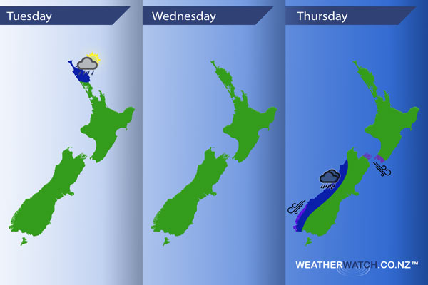
Blue – There is the chance of a few isolated heavy showers about Northland in the afternoon, with a low risk that one or two of these may produce a thunderstorm. Most won’t experience or see anything, however, there is the chance you could catch a short / sharp heavy shower before it eases in the evening.
Wednesday
No risky or adverse weather, mainly settled due to a ridge of high pressure.
Thursday
Blue – Heavy rain moves onto South Westland from afternoon then spreads northwards in the evening / overnight.
Purple – Northwesterly winds become strong about the Cook Strait area from afternoon, with winds gusting to gale at times. Northeasterlies become strong about coastal Fiordland from afternoon, then ease in the evening.

– Please note, the idea behind this update is to focus on the main weather highlights, which is why not all regions are mentioned.
For specific 10 day information for your city, town, rural community or island please see the 1000 forecasts on our homepage!
– Aaron Wilkinson, WeatherWatch.co.nz
Comments
Before you add a new comment, take note this story was published on 29 Aug 2016.


Add new comment