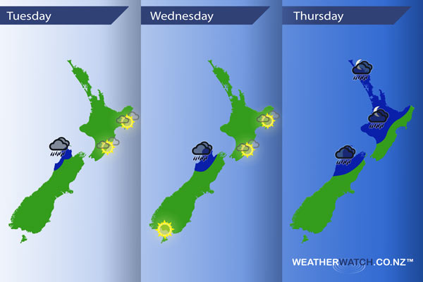
InfoGraphic: The Main Weather News Highlights across NZ: Tue, Wed, Thu
8/05/2017 7:00pm

> From the WeatherWatch archives
A low sits in the Tasman Sea today while a large high is centred just to the northeast of New Zealand. In between lies a front which sits over northwestern parts of the South Island during the day. On Wednesday the front becomes more organised just out to the west while a low builds in the Tasman. A frontal system moves over the North Island later in the day / overnight while ex tropical cyclone Donna positions itself northeast of the North Island overnight.
Tuesday
Blue – Rain about Tasman and parts of Buller may be heavy at times from afternoon as a front feeds into the northwestern corner of the South Island.
A mainly sunny day for the eastern North Island with light winds and warm temperatures.
Wednesday
Blue – Rain remains heavy at times for the northwest of the South Island.
Mainly sunny for the east of the North Island once again, just some high cloud at times. A great day about Southland and Otago with some evening high cloud.
Thursday
Blue – Rain about the northwest of the South Island is heavy at times during the day then easing in the evening. From evening rain becomes heavy about the western North Island then pushing over much of the North Island overnight where rain could become torrential in some regions.

– Please note, the idea behind this update is to focus on the main weather highlights, which is why not all regions are mentioned.
For specific 10 day information for your city, town, rural community or island please see the 1500 forecasts on our homepage!
– Aaron Wilkinson, WeatherWatch.co.nz
Comments
Before you add a new comment, take note this story was published on 8 May 2017.


Add new comment