> From the WeatherWatch archives
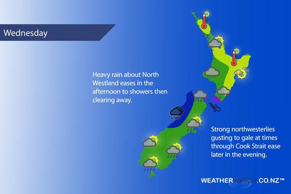
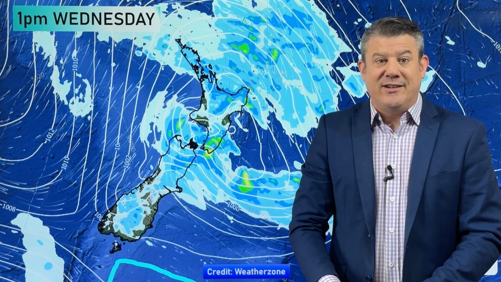
A weakening front moves off the top of the South Island then onto the lower North Island in the afternoon on Wednesday, northwest winds ahead of the front and changing to the southwest in behind.
A mix of sun and cloud for the upper North Island, sun more likely in the afternoon. West to northwesterly winds.
Cloudy about the lower North Island in the west with patchy rain or drizzle from afternoon, breezy west to northwesterly winds. Plenty of high cloud for the east coast although some sun breaking through at times, the odd spot of rain spreads into the Wairarapa from afternoon (clearing evening) then perhaps further north overnight. Northwesterly winds.
Cloudy with patchy rain or drizzle developing in the morning about the capital, clearing later in the evening. Strong northwesterly winds gusting to gale at times.
Thick high cloud about Nelson and Marlborough, a few spots of rain in the afternoon / early evening (especially about Nelson) otherwise mainly dry. Brisk to strong northwesterly winds. A few morning showers then clearing for Canterbury, afternoon sunny spells break through. Southerlies tend easterly in the evening.
Heavy morning rain eases to showers around midday on the West Coast which clear in the afternoon, breezy northerlies change southwest.
Sunny spells about Southland, westerlies becoming brisk to strong in the afternoon with the chance of a shower or two. Otago sees any early showers clear, dry for a time with some sun then an isolated shower or two is possible again in the afternoon and early evening.
Blue – Heavy form of precipitation.
Purple – Strong winds
Yellow – Temperatures around the mid 20 degree mark or over.

Not all regions and towns have been mentioned above. For specific 10 day information for your city, town, rural community or island please see the 1500 forecasts on our homepage!
– Aaron Wilkinson, WeatherWatch.co.nz
Comments
Before you add a new comment, take note this story was published on 31 Jan 2017.


Add new comment