> From the WeatherWatch archives
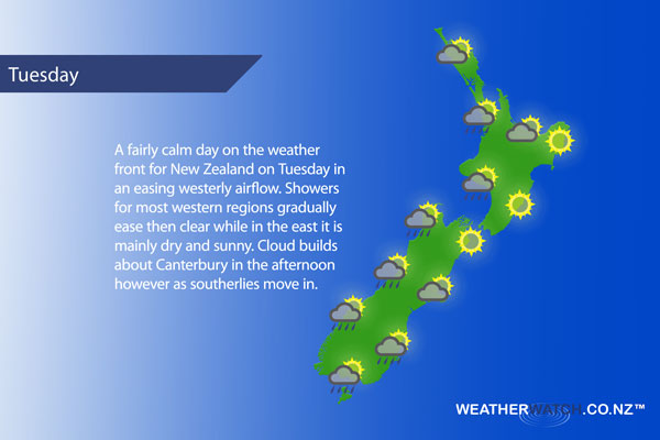
A westerly airflow eases over New Zealand on Tuesday meanwhile a low in the Tasman Sea brews and moves a little closer to the western side of the country during the day.
Morning cloud brings the risk of a shower about the upper North Island (especially in the west) then sunny areas increase, winds light from the north to northwest. Overnight some rain moves into Northland.
Morning cloud with a few showers clearing about the lower western North Island, sunny spells then break through. Light west to northwesterly winds. Any morning cloud clears along the east coast then mainly sunny with northwesterly winds, light winds may tend northeasterly in the afternoon about Hawkes Bay.
Morning cloud breaks to mostly sunny weather for Wellington, easing north to northwesterly winds.
Sunny about Nelson and Marlborough with light north to northwesterly winds. A mostly sunny morning for Canterbury, light winds change southerly in the afternoon bringing increasing cloud. Some late afternoon / evening drizzle possible for South / Mid Canterbury.
A few morning showers for the West Coast then drying out, areas of sun gradually increasing. Southwesterlies.
A few showers about Southland, becoming drier into the afternoon with some sun breaking through. Still, the odd shower may hang around till evening. Otago sees a mix of sun and cloud then a few showers late afternoon / evening. West to southwesterly winds.
Blue – Heavy form of precipitation or cold temperatures, typically below 1 to 2 degrees celsius.
White – Snow
Purple – Strong winds.
Yellow – Temperatures around the mid 20 degree mark or over.

Not all regions and towns have been mentioned above. For specific 10 day information for your city, town, rural community or island please see the 1500 forecasts on our homepage!
– Aaron Wilkinson, WeatherWatch.co.nz
Comments
Before you add a new comment, take note this story was published on 28 Aug 2017.


Add new comment