> From the WeatherWatch archives
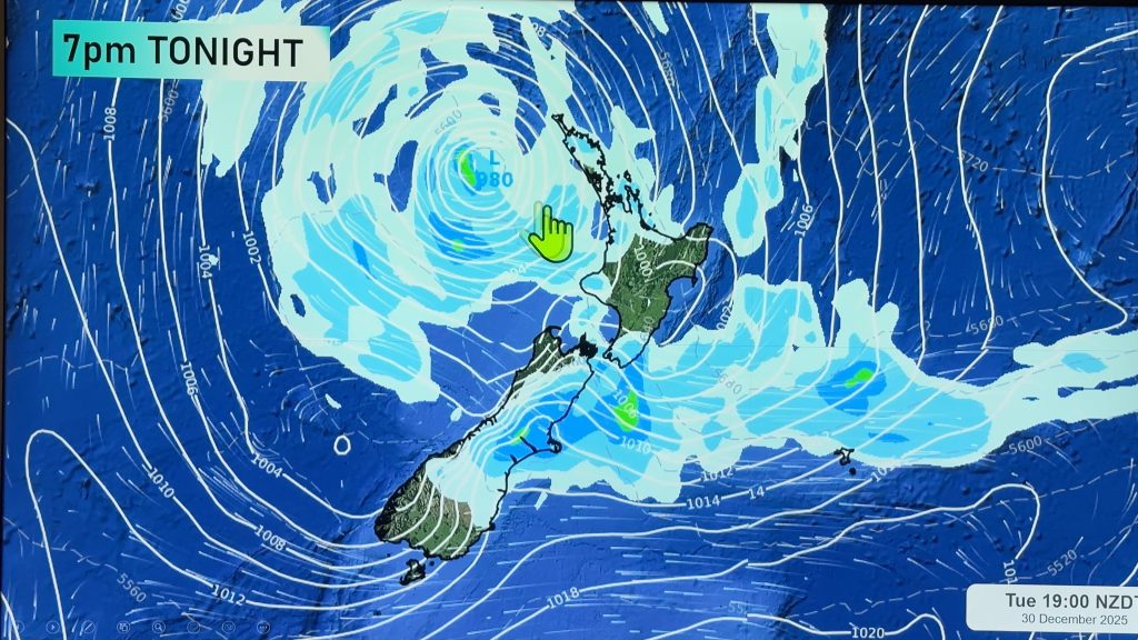
Ex Tropical Cyclone Cook moves onto northern New Zealand around midday on Thursday then moves southwards down the country in the evening and overnight. Very strong winds and heavy rain will be associated with this low and the areas most affected will be determined by where this deep low moves although it is likely to be regions in the north and northeast of the North Island then the lower North Island, upper South Island and eastern South Island overnight.
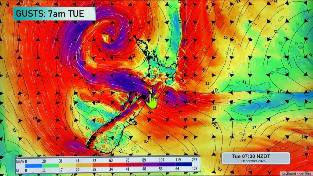
A very complicated graphic to describe, we have Ex Tropical Cyclone Cook moving onto the north of the country around midday or early afternoon then pushing southwards in the evening and overnight. With this strong low brings the potential for heavy rain (torrential falls for some) and very strong winds. Any subtle shift in the centre of this low could result in a very different outcome for various regions regarding rain and wind. However current indications are that most parts of the North Island could experience some heavy rain during the day, then the top of the South Island and eastern South Island overnight.
The most intense areas being Auckland, Waikato, Bay Of Plenty and perhaps parts of the Central North Island and northern Taranaki. These areas of very heavy rain will build in the afternoon then ease from evening although not easing about Taranaki till overnight. A risk of torrential falls and flooding is possible. Heavy rain is also likely in the ranges running from Gisborne down through to the Wairarapa however it will be coming from the west then easing evening / overnight.
As noted above very strong winds are likely with this low. Winds will strengthen from the east in the afternoon about the upper North Island with severe to storm force gales possible about eastern areas then winds change around to the northwest in the evening once the low moves through. Northwest winds could be equally as strong for a time when the change kicks in then easing away fairly quickly. Very strong north to northeasterly winds push down the eastern side of the country during the evening and overnight, ahead of this strong southeasterly winds may build about coastal Canterbury overnight. Winds through Cook Strait could be very strong from the north for a time overnight.
Gusty southeasterly winds about coastal parts of the lower South Island ease away in the morning.
As for other parts of the country, rain about coastal Otago may be heavy at times then easing in the afternoon before picking up again overnight. The West Coast sees showers and sunny spells, showers and dry spells for Southland and Central Otago.
Blue – Heavy form of precipitation.
Purple – Strong winds.
Yellow – Temperatures around the mid 20 degree mark or over.

Not all regions and towns have been mentioned above. For specific 10 day information for your city, town, rural community or island please see the 1500 forecasts on our homepage!
– Aaron Wilkinson, WeatherWatch.co.nz
Comments
Before you add a new comment, take note this story was published on 12 Apr 2017.


Add new comment