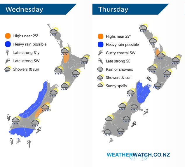
InfoGraphic: The Big Picture for Wednesday / Thursday
20/03/2018 6:00pm

> From the WeatherWatch archives
A cold front moves northwards over the South Island today while a slim ridge of high pressure holds on further north. This front moves onto the North Island on Thursday meanwhile expect cool southerlies further south.
Isolated showers and sunny spells for many North Island regions today, showers are more likely in the afternoon then easing this evening. Some spots may stay dry all day depending on where showers hit.
Heavy rain pushes northwards along the West Coast of the South Island during today, easing in behind with a southwest change. Rain also moves north along the east coast, rain may become fairly persistent / heavy about Southland and Otago from late afternoon then easing overnight. South to southwesterly winds freshen about the lower South Island from afternoon becoming strong in the evening about coastal areas.
A dry morning once again for many North Island regions on Thursday then showers develop in the afternoon, Taranaki through to Wellington sees rain from afternoon as light winds tend southeast becoming gusty through Cook Strait. Morning rain eases to showers for the eastern South Island, rain first thing could be heavy about Nelson and Marlborough. Morning showers in the west clear to mostly sunny weather.

By Weather Analyst Aaron Wilkinson – WeatherWatch.co.nz
Comments
Before you add a new comment, take note this story was published on 20 Mar 2018.


Add new comment