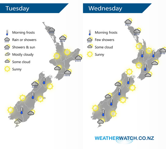
InfoGraphic: The Big Picture for Tuesday / Wednesday
24/06/2019 7:00pm

> From the WeatherWatch archives
Quite anticyclonic today and again on Wednesday, southeasterlies about the far north.
Rain for Northland today, also a few exposed northeastern areas like northern Auckland, Great Barrier Island and the Coromandel. A shower or two continues to skim along the east coast during the day, mostly sunny out west after any morning cloud breaks away. The South Island is fairly sunny, some cloud about North Westland may bring a shower or two however. Skies quite cloudy about Southland, sunnier the further north you move into Otago.
Fairly settled across most of New Zealand on Wednesday, a few showers continue to push into Northland (especially in the east) in a southeasterly airflow. Some coastal cloud as indicated below for some regions.

By Weather Analyst Aaron Wilkinson – WeatherWatch.co.nz
Comments
Before you add a new comment, take note this story was published on 24 Jun 2019.


Add new comment