High pressure crosses NZ, slides eastwards today
16/10/2024 3:00pm

> From the WeatherWatch archives
High pressure is moving over NZ and will linger east of the country across the upcoming weekend.
Let’s get into the forecast for Thursday to begin with…
RAIN:
Apart from a few morning showers around Northland and maybe an isolated afternoon shower around Waitomo or Taranaki, NZ is dry today. In fact, all regions lean drier than average for this time of year over the next 7 days.
WIND:
Winds are light and variable around NZ although a cooler southerly flow remains from about Banks Peninsula up to the lower North Island and up the eastern North Island to about Gisborne where it fades away.
TEMPERATURES:
After a cold start for some, many places have a fairly average temperature today – in fact by afternoon in land areas may well be warmer than usual for mid October.
DAYS AHEAD
Friday is similar although now the shower risk is along the western side of the South Island and east to north-east winds develop in the upper North Island.
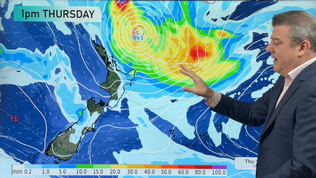
This weekend high pressure parked over the Chatham Islands keeps a general north-east flow over the country and both days have isolated afternoon downpour risks inland for both main islands, especially Saturday in the eastern South Island.
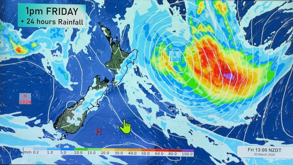
Finally – A storm between East Cape and Tonga is still worth monitoring this weekend and into early next week – although modelling still keeps it offshore from the North Island, but it’s close enough to monitor especially this Sunday and Monday and may impact beaches and surf conditions in the east from Northland to Gisborne. It is not forecast to hit NZ directly but is close enough and big enough to keep an eye on.

As always drill down deeper with your hyper-local, hourly, FREE 10 day forecasts from WeatherWatch.co.nz – or download the FREE WeatherWatch App.
Comments
Before you add a new comment, take note this story was published on 16 Oct 2024.
Latest Video

Australia: Will Tropical Cyclone Narelle track along half of Oz’s entire coastline?
Tropical Cyclone NARELLE has formed and is heading into northern parts of FNQ, the Katherine region of NT and then…
Related Articles
NZ 9 Day: Two subtropical lows, but a lot of dry weather
In our extended outlook today we track two subtropical storms, one that will likely miss most of NZ while the…
Subtropical low (yes, another one) to brush the NI, high pressure still in charge
A subtropical low will power up over the next 24 hours and brush past the north-eastern corner of the North…
NZ weather: Skies will get drier before they get any wetter
High pressure is the main feature of New Zealand’s weather this week, the upcoming weekend and likely kicking off next…


Add new comment