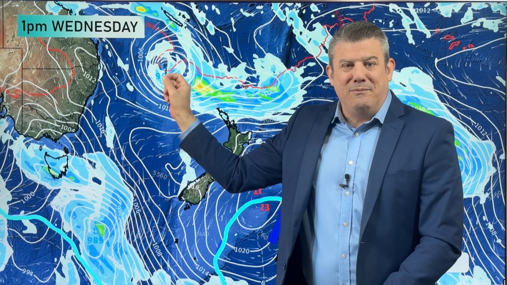
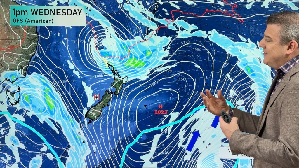
Front coming in from the southwest, strong winds in the south
12/05/2025 11:04pm

Situation
A cold front pushes in from the southwest today, already Southland and the West Coast is being affected with showers or some rain, eventually cloud with a few showers spreads up the east coast of the South Island. Pleasant in the east before the front moves in thanks to a westerly quarter drift.
Rain
The South Island attracts the most wet weather today but it won’t be a deluge or anything or the sort, showers or a little rain in the west and for Southland. As cloud thickens for Canterbury this evening there may only be a few drizzle patches about. Parts of the western North Island see a shower or two drift in from the Tasman at times.
Temperatures
Warm reaching into the late teens for eastern regions today and for much of the upper North Island, the eastern North Island may hit the early twenties. Cool further south with Invercargill likely to get no higher than 13, these cool temperatures with spread north in the east reaching Canterbury mid to late afternoon as the day progresses.
Winds
Coastal Southland and Otago have strong west to southwesterly winds today, there is a chance winds may gust to gale force at times then easing from this evening. Elsewhere we aren’t too bad although westerly quarter winds will be fresh at times for the western North Island and southerlies will be fresh and a little gusty for coastal Canterbury when they hit.
Upcoming potential severe weather
A low pressure system on Sunday is still the one to watch, moving in from the Tasman then crossing over out east. Heavy rain in the west developing in the wee small hours with strong northerlies spreading over New Zealand. Winds then change strong southwest in behind with gales up the eastern side.

Beyond that there may be some more unsettled weather next week before a huge high next weekend.
Main story image: Rain / MSLP Tuesday 13th May 2025 12:00pm – GFS Weatherzone.com.au
Comments
Latest Video

Temperatures to lift, before dropping again this weekend
Subtropical and north-west winds will help boost temperatures around NZ both by day and night followed a colder couple of…
Related Articles
Temperatures to lift, before dropping again this weekend
Subtropical and north-west winds will help boost temperatures around NZ both by day and night followed a colder couple of…
Subtropical low vs subantarctic energy = typical early Autumn setup
A low pressure zone leaving Queensland tonight may brush the very top of the North Island midway through this week…
Subtropical low next week worth monitoring as high pressure controls all
High pressure smothers NZ today and will weaken a little on Sunday and Monday to allow a cooler southerly flow…


Add new comment