Friday Newsfeed: NI low continues to weaken as high pressure expands (+5 Maps)
8/08/2024 4:00pm

> From the WeatherWatch archives
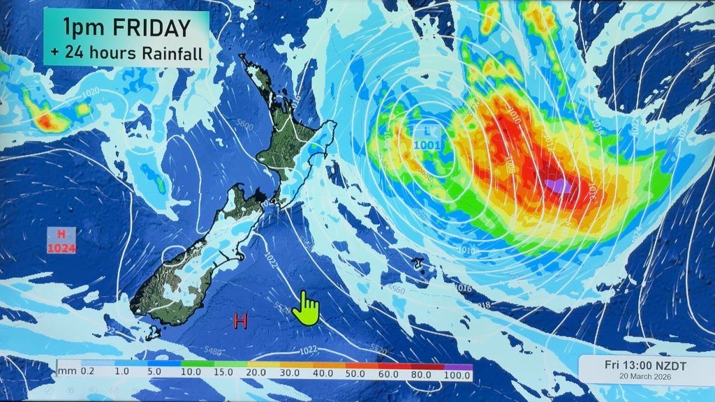
A very weak low covers the North Island for Friday, but the air pressure is more like high pressure with the centre of the low around 1021 or 1022 hPa – and it’s falling apart. It means a high chance of cloud, showers and patchy rain – but rainfall totals may not be very much and not everyone will get wet weather due to the very weak nature of this low. Over the South Island high pressure is expanding following a pulse of sub-antarctic air yesterday, which means frosts are coming back for some inland and higher elevation.
RAIN:
Patchy rain and showers are again broken up on Friday with most wet weather around the eastern side of the North Island, but is possible in other regions too for a time. Track it on rain radar as this is a messy setup and there’s a fine line between just a few showers or completely dry. The South Island is mostly to completely dry but a few showers are possible in the northern half.
WIND:
Winds aren’t too strong for Friday in most places – but southerlies pick up around Wellington, Cook Strait and southern Wairarapa for a time – otherwise winds are easing as we go into Saturday due to the low weakening further and high pressure increasing.
TEMPERATURES
Slightly colder air moves up the South Island and into the lower North Island, otherwise temperatures don’t shift much on Friday from where they were yesterday, although overnight lows drop through the South Island bringing frosts tonight inland and maybe tomorrow night too.
As always drill down deeper with your hyper-local, hourly, 10 day forecast at WeatherWatch.co.nz or download our app.


Comments
Before you add a new comment, take note this story was published on 8 Aug 2024.
Latest Video

High pressure grows, but a stormy end to next week possible
A settled weekend is on the way and apart from a few isolated showers in both main islands many regions…
Related Articles
High pressure grows, but a stormy end to next week possible
A settled weekend is on the way and apart from a few isolated showers in both main islands many regions…

A tropical low next week *might* affect NZ
It’s not locked in yet, but a tropical storm may end up drifting southwards towards NZ about one week from…
NZ 9 Day: Two subtropical lows, but a lot of dry weather
In our extended outlook today we track two subtropical storms, one that will likely miss most of NZ while the…


Add new comment