Sunday Newsfeed: Low pressure falls apart, westerlies about to return (+2 Maps)
5/10/2024 5:48pm

> From the WeatherWatch archives
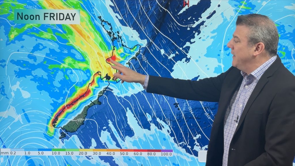
This weekend low pressure moves in to NZ from the Tasman Sea bringing further rain/showers to the western side – but it falls apart, leaving a showery north-westerly flow in its wake, especially over the North Island.
The westerly set-up carries on into Sunday, Monday and Tuesday with a low south of the country on Wednesday likely returning rain to the West Coast and windier westerlies over the North Island, thanks to high pressure north of NZ.

Keep up to date with MetService warnings and watches – and as always, drill down deeper with your hyper-local, hourly, 10 day forecasts at WeatherWatch.co.nz – or download our Free WeatherWatch App.
Latest Video
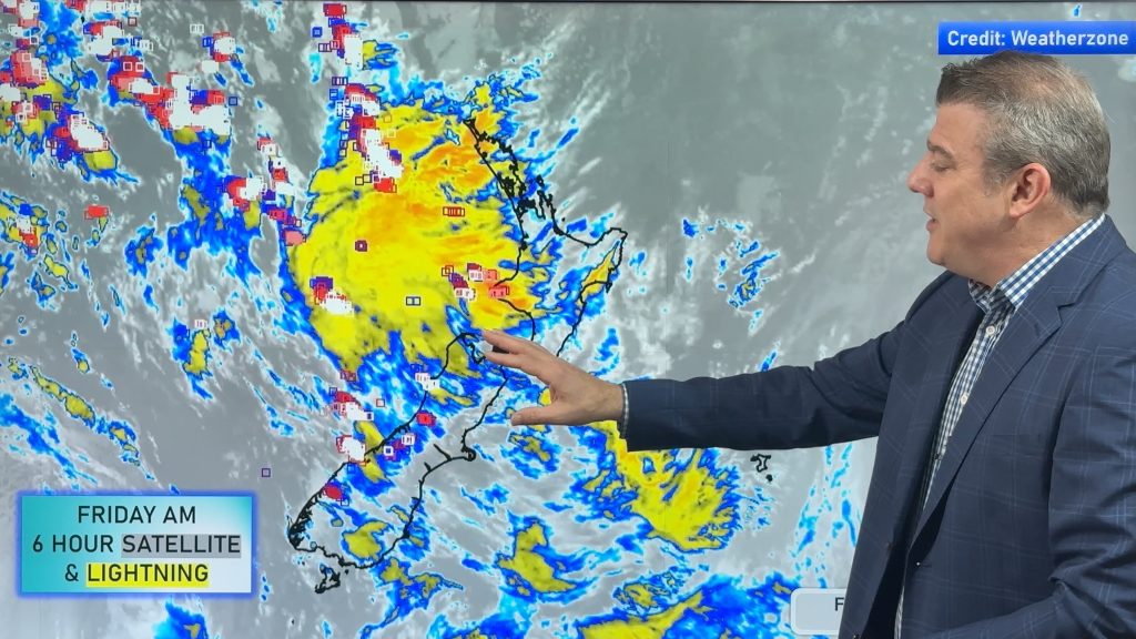
Thunderstorms & downpours as cold front moves through
More heavy downpours and thunderstorms are expected across Friday and into Saturday as a cold front moves through and clears…
Related Articles
Thunderstorms & downpours as cold front moves through
More heavy downpours and thunderstorms are expected across Friday and into Saturday as a cold front moves through and clears…
Cold front incoming, rain, showers and thunderstorms in the mix
Low pressure in the Tasman Sea is moving into the South Island and will bring more heavy West Coast rain…

ClimateWatch: JUNE outlook as El Niño continues to build
June has kicked off in NEUTRAL again as far as El Niño is concerned, but it is expected to form…

