Cyclone Jasper: Heavy Rain & coastal flooding the two main concerns as of today
10/12/2023 10:55pm

> From the WeatherWatch archives
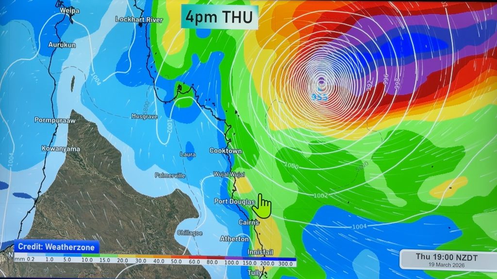
Cyclone Jasper is still another day or two away from hitting Queensland more directly and rain looks like it may be the main problem as the slow moving tropical cyclone moves in.
Warmer sea conditions hugging the Northern Queensland Coastline along with the slow movement of Jasper tomorrow and Wednesday means the storm may start to deepen again.
Even if it doesn’t restrengthen much Jasper looks to be a wet event with 300 to 500mm possible, depending on the precise tracking and speed, falling in just a day or two.
The Bureau of Meteorology is the official source for warnings – please follow them for local details. We’ll continue with special video updates both Tuesday and again on Wednesday of this week for Queensland via WeatherWatchTV on YouTube.
*Programming Notes:
– Our next 7 Day Pacific Islands forecast is out on Tuesday
– We’ll have another special Cyclone Jasper video out on Tuesday and Wednesday
– Our next 7 Day Australia-only forecast is out this Thursday, all exclusive content to WeatherWatchTV on YouTube.
Comments
Before you add a new comment, take note this story was published on 10 Dec 2023.


Add new comment
janet on 11/12/2023 5:35am
wow thats a storm is there likely that wind changes could blow this down aussie coast an get caught up with weather coming to us in nz .thankyou
Reply