> From the WeatherWatch archives
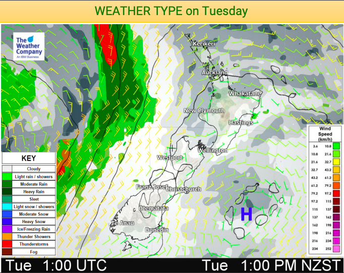
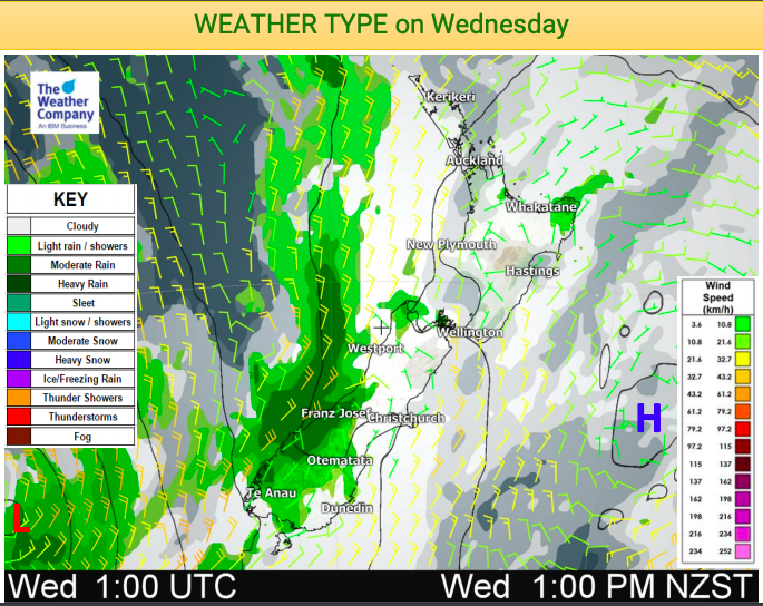
After a sunny weekend in many places this week’s more sub-tropical airflow is likely to encourage more cloud. The cloud will be at varying heights with high cloud over a large part of New Zealand today and tomorrow but also areas of low cloud and even fog.
Combined it may make for some gloomy weather and colder mornings. However for those who get the sun (and for many who still have fairly cloudy skies actually) the afternoon temperatures look above average for this time of the year.
The high cloud will also contribute to some fantastic sunrises this week (perhaps more so than sunsets with more cloud expected out to the west). This morning fiere red and orange skies were seen across New Zealand as the rising sun lit up the high cloud.
Fog patches are also possible due to the light winds and more humid air flows. This may affect some flights and driving speeds on highways.
Here are three maps showing where the clouds will most likely be, also wind directions/speeds and rain-bands.
WEATHER MAPS FOR NEW ZEALAND: Monday, Tuesday, Wednesday:


– WeatherWatch.co.nz Exclusive
Comments
Before you add a new comment, take note this story was published on 6 May 2019.


Add new comment