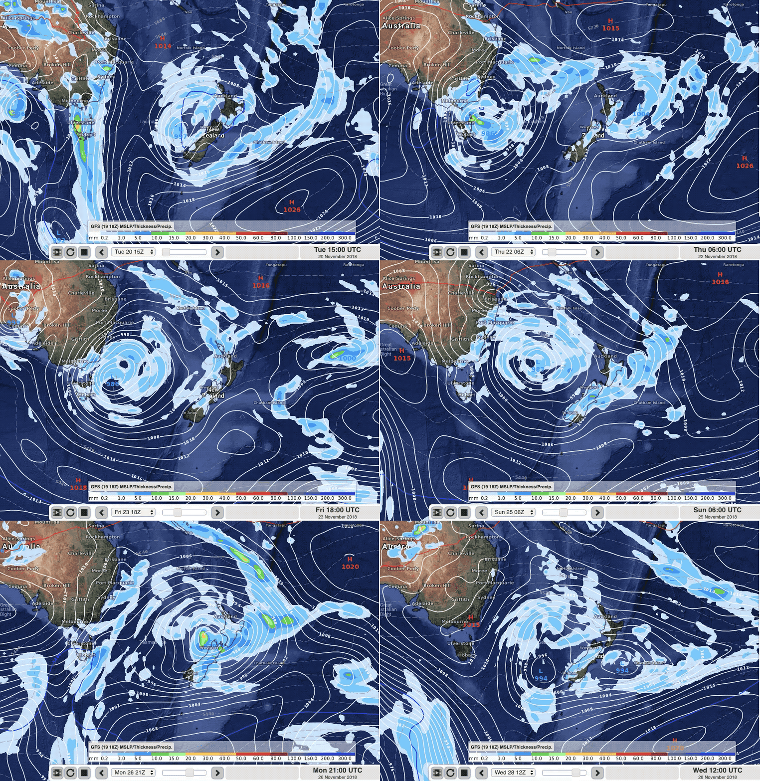
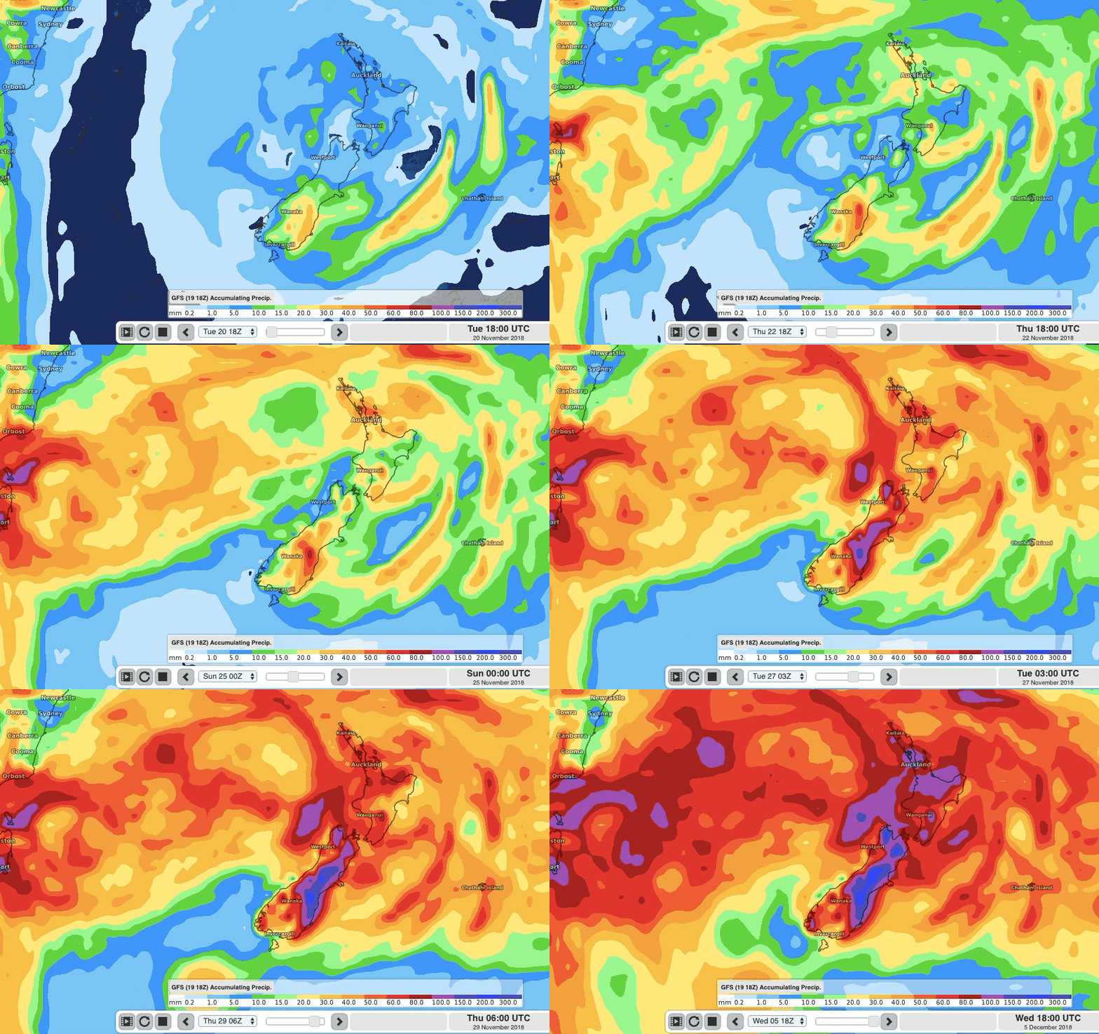
Animations (x3) showing low pressure and total expected rainfall across NZ until early December
20/11/2018 5:16pm

> From the WeatherWatch archives
New Zealand looks set to be dominated by low pressure for the rest of November and that means more rain is coming. These three animations below, covering the next 8 to 14 days, show the current best thinking of where the lows should track, how large they will be and their likely rainfall.
There are two important things to note about the expected rain:
1) The next low moving in this weekend (like the one we have right now) is very large in size, with a combination of rainy areas, showery areas and large completely dry zones too. These rain and shower bands are broken up and will change shape a bit over the coming days and weeks. While the overall size of the low(s) and likely rainy areas are expected to track oveer New Zealand, the precise shape and timing may likely change – especially the further out we go from today. But you get the general picture!
2) Another component is that we’re expecting more isolated downpours and thunderstorms in both islands, mostly inland. This means there will be some very heavy but localised downpours – ‘localised’ meaning you may stay dry while some just down the road could end up with some pockets of minor flooding. The very nature of these afternoon and evening downpours is that while you can have high confidence of them forming, the precise spot they bubble up in can move around depending on sea breezes etc…but the ranges and inland areas are highest candidates for them to form. The daily rain maps we have in our MAPS tab are still the best way for you to see where any downpours might flare up nationwide…the more days you go out, the less accurate they generally become though.
ANIMATIONS:
Low Pressure Dominates New Zealand for rest of November:
Forecast Rain is now added to these air pressure maps (please note this animation only goes out until November 8).
Total Expected Rainfall Accumulation between today and early December. Due to the patchy/broken nature of the incoming rain bands and the afternoon downpours (which will flare up here and there across both islands in the week to come) the below totals will likely shift around a little, but you get the general idea of the new weather pattern New Zealand has – it’s wetter until December:
– WeatherWatch.co.nz – New Zealand’s weather news authority.
Comments
Before you add a new comment, take note this story was published on 20 Nov 2018.


Add new comment